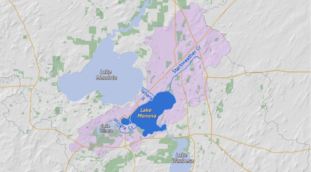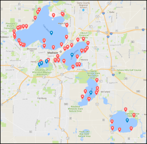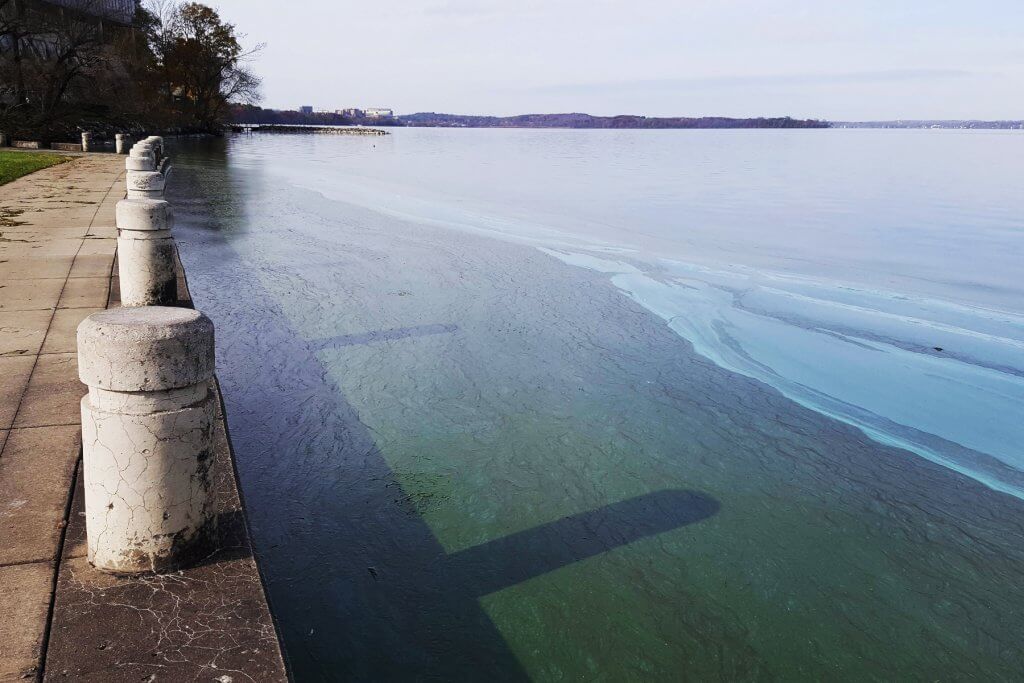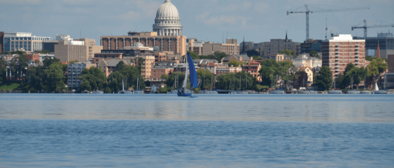
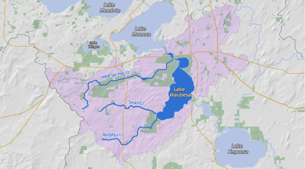
Lake Waubesa
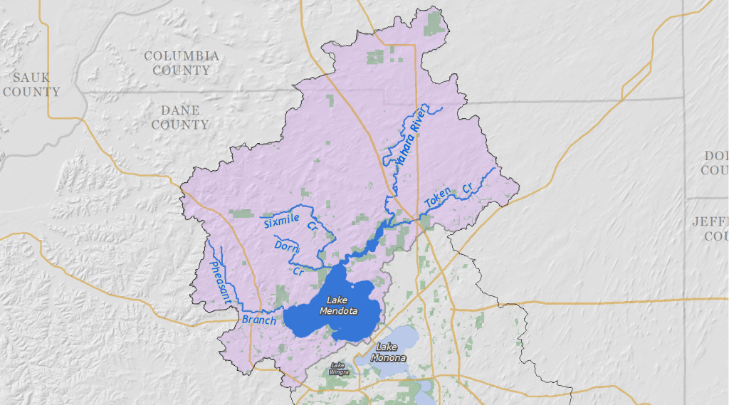
Lake Waubesa is the third in the Yahara chain of lakes as the Yahara River flows south from Lake Monona through Upper Mud Lake. The watershed has a mix of urban and rural land use. Work in the Mendota and Monona watersheds to prevent phosphorus runoff is helping Lake Waubesa since much of the phosphorus in the lake flows from the upper lakes in the chain.
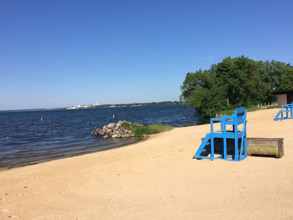
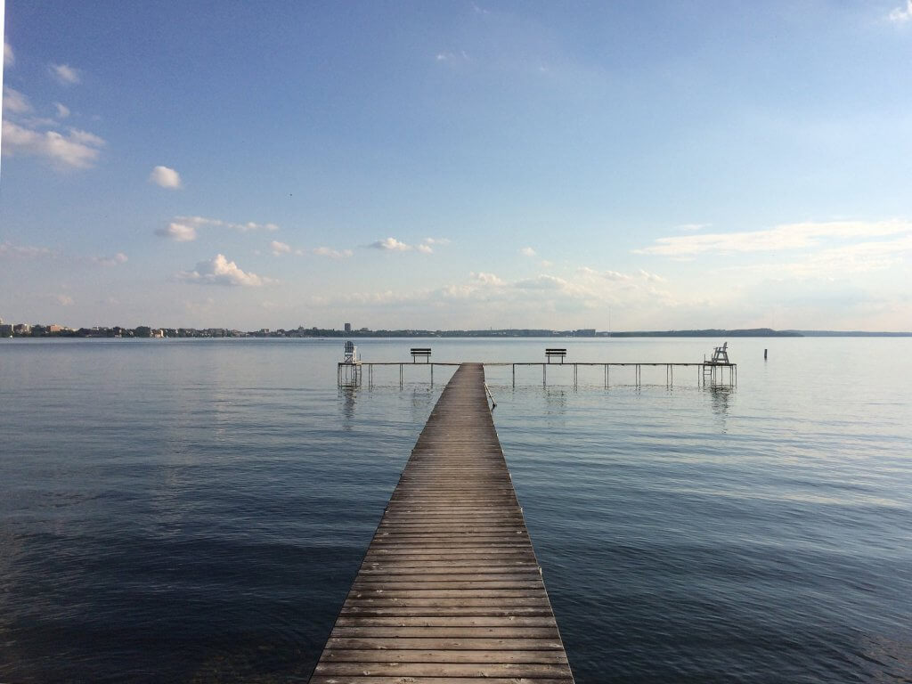
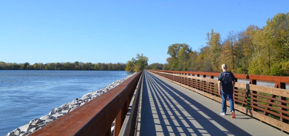
The north end of Lake Waubesa is surrounded by the Capital Spring State Recreation Area and features the new Lower Yahara River Trail and bike-pedestrian bridge. The south end of the lake receives spring water from Swan Creek, Murphy Creek and Bogholt Deep Spring, which buffers the high-quality Waubesa Wetlands from nutrient runoff. The outlet of the Yahara River sits at the east shore of the lake and runs south towards Lower Mud Lake before joining Lake Kegonsa. Goodland County Park on the western shore of the lake contains the only public beach on Lake Waubesa.
Most of the phosphorus entering the lake each year comes from the upper lakes via the Yahara River, although summer phosphorus levels may also be driven by runoff within the watershed (McDonald & Lathrop, 2016). Efforts to reduce the sources of upstream runoff will reduce the amount of phosphorus entering the lake via the Yahara River outlet (83% of the average annual phosphorus load).
The Yahara CLEAN plan for the Lake Waubesa Watershed calls for action to improve agricultural practices and improve control of construction erosion. Phosphorus reduction in the Lake Waubesa Watershed will come primarily from improving agricultural practices and improving control of construction erosion.
Lake Waubesa by the numbers
Lake Waubesa is a shallow lake, and water flushes through the lake relatively quickly (three months) compared to the deeper lakes.
- Watershed area: 28,160 acres
- Surface area: 2,080 acres
- Shoreline: 9 miles
- Maximum depth: 34 feet
- Mean depth: 16 feet
- Flushing rate: 2.8 months
How was the water (2019)?
2019 average (July – August) water clarity ranked “good” and phosphorus concentrations ranked “fair,” according to Wisconsin DNR criteria for shallow lakes.
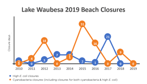
The beach at Goodland County Park was open all summer, likely due to the exclosure maintained by Dane County in 2019 to enhance the water quality at the beach. One Lake Waubesa beach is monitored.
2019 community projects & initiatives
- Town of Dunn passed an assessment to allow for the purchase of development rights for the purpose of preserving agricultural land and natural areas.
- Town of Dunn partnered with Lake Waubesa Conservation Association and Dane County Parks to offer a new leaf-collection site at Goodland County Park. This allowed an additional 780 cubic yards of leaves to be collected, bringing the total to 6,000 cubic yards of leaves for the 2019 season.
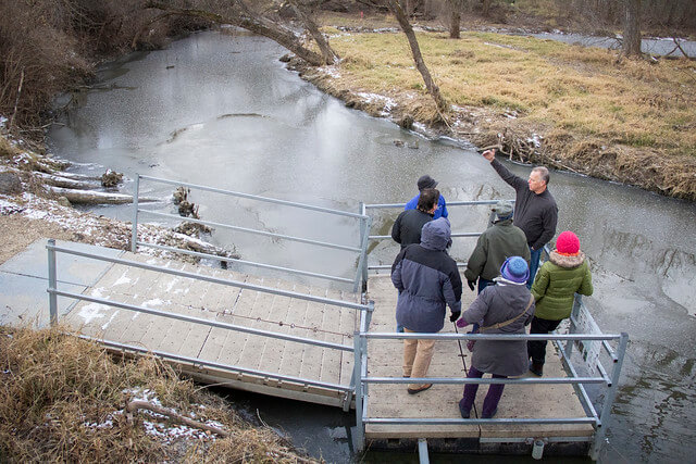
- Friends of Capital Springs Recreation Area received a Foundation for Dane County Parks grant to develop educational and interpretive resources for an outdoor space at the Lussier Family Heritage Center.
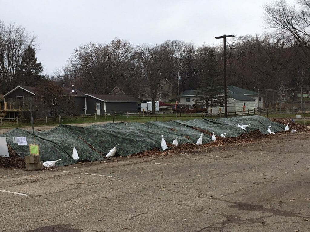
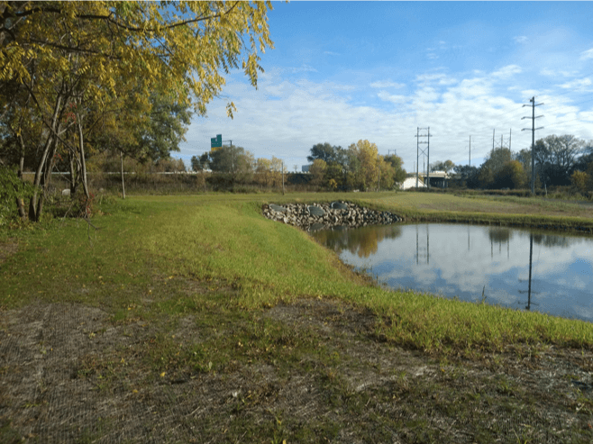
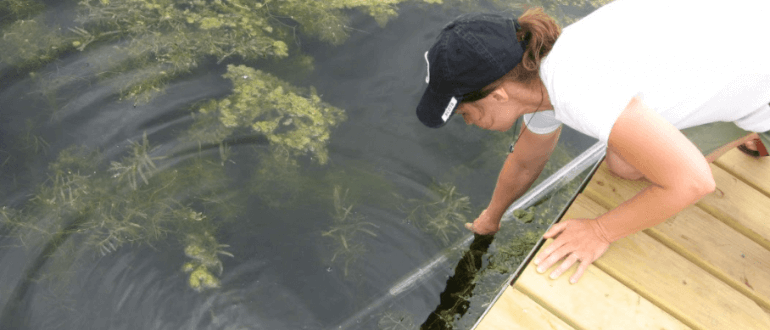
Photo credit: Lake Waubesa Conservation Association
For an update on phosphorus reduction projects, see the State of the Lakes Annual Report.
Organizations supporting Lake Waubesa
The following groups work on water quality issues in the Lake Waubesa watershed. Consider contacting an organization near you to get involved and let us know if we have missed your group.
- City of Fitchburg
- Dane County
- Friends of Capital Springs Recreation Area
- Friends of Waubesa Wetlands
- Lake Waubesa Conservation Association
- Madison Metropolitan Sewerage District
- Public Health Madison & Dane County
- Yahara Pride Farms
- Yahara Watershed Improvement Network
Read about the other lakes in the Yahara Watershed
Here’s how Lake Waubesa faired in previous years:
Lake Waubesa 2018
How was the water?
In 2018, total phosphorus levels were “fair” and water clarity was “good” in the middle of the lake, according to DNR criteria, but the nine citizen monitor reports of cyanobacteria blooms were above the 4-year summer median of four.
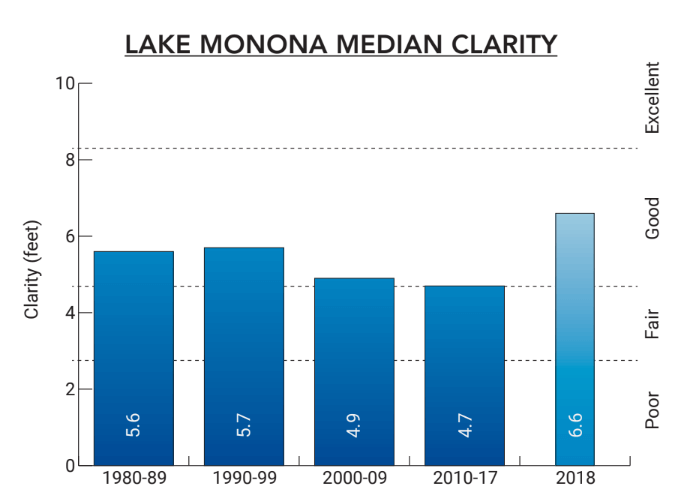
Water clarity (2018 data)
- 3.9 feet or "good" according to Department of Natural Resources criteria for shallow lakes
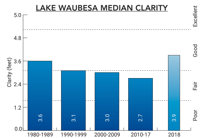
Data WDNR (1975-1994), NTL-LTER (1995-2018)
Phosphorus levels
- 0.065 mg/L or "fair" according to Department of Natural Resources criteria for shallow lakes
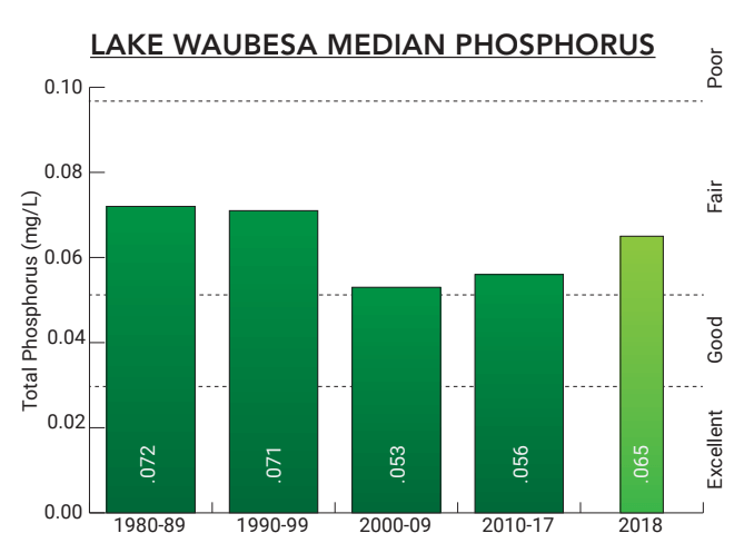
Data WDNR (1975-1994), NTL-LTER (1995-2018)
Beaches (2018 data)
- Closed 22% of the time and open 78% of the time
- 9 closure days due to cyanobacteria (blue-green algae)
- 0 closure days due to E. coli bacteria
- 0 closure days due to the combinations of cyanobacteria and E. coli
- 13 closure days due to flooding
Based on data collected by Public Health Madison & Dane County, Lake Waubesa beaches were closed nine days from Memorial Day to August 20th, compared to the 2010-17 median of 15, all due to cyanobacteria. After August 20th, all the beaches were closed for the remainder of the season (August 21 – Labor Day) due to flood conditions.
What's new on Lake Waubesa?
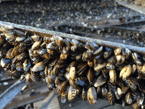
Lake Waubesa summer water quality conditions are linked to the recent invasion of zebra mussels. The full effect of zebra mussels in the Yahara lakes is still uncertain. Results from other infested lakes suggest increases in water clarity in the middle of the lakes will occur. However, shoreline management problems could get worse from increased aquatic plant growth, and possible increases in filamentous algae and scums of cyanobacteria.
Summer water quality in 2018 was also impacted by the unusual amount of flow into and out of the lake resulting from above normal precipitation in the region.
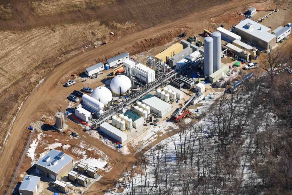
Photo courtesy of Dane County
2018 Lake Waubesa projects
- Dane County
- Spent $5.5 million to build a renewable natural gas (RNG) off-loading station as part of a $28 million county RNG facility. Other RNG producers, like dairy digesters located north of Lake Mendota, can bring their fuel and inject it into the pipeline making it economically feasible to produce renewable energy and clean up our lakes
- Permanently protected 35 acres in the southern Waubesa Wetlands Natural Resource Area
- Installed an exclosure to improve Goodland County Beach water quality
- Village of Cottage Grove restored a 1.5-acre wetland on the north edge of the village, called “Conservancy Court Wetland.”
- Capital Area Regional Planning Commission worked with the University of Wisconsin-Madison to study the Waubesa Wetlands and make management recommendations. As a result of their study and community engagement, the Friends of Waubesa Wetlands was formed in 2018.
- Friends of Waubesa Wetlands formed at the end of 2018 and held workdays throughout the year to remove invasive species and improve wildlife habitat.
Lake Waubesa 2017
Water clarity (2017)
- 3.3 feet or "good" according to Department of Natural Resources criteria for shallow lakes
Phosphorus levels (2017)
- 0.087 mg/L or "fair" according to Department of Natural Resources criteria for shallow lakes
Beaches (2017)
- Open 79% of the time and closed 21% of the time
- 21 closures days due to E. coli bacteria
- No closures due to cyanobacteria (blue-green algae)
Lake Waubesa 2017 news
The Lake Waubesa beach at Goodland County Park was closed 21 times (out of a total 99 possible beach days), all due to high E. coli bacteria.
Lake Waubesa 2016
Water clarity (2016)
- 3.6 feet or "good" according to Department of Natural Resources criteria for shallow lakes
Phosphorus levels (2016)
- 0.044 mg/L or "good" according to Department of Natural Resources criteria for shallow lakes
Beaches (2016)
- 1 closure due to E. coli bacteria
- 10 closures due to cyanobacteria (blue-green algae)
- 6 closures due to the combination of E. coli bacteria and cyanobacteria
Lake Waubesa 2015
Water clarity (2015)
- 3.0 feet or "good" according to Department of Natural Resources criteria for shallow lakes
Phosphorus levels (2015)
- 0.054 mg/L or "good" according to Department of Natural Resources criteria for shallow lakes
Beaches (2015)
- 2 closures due to E. coli bacteria
- 21 closures due to cyanobacteria (blue-green algae)
- 10 closures due to the combination of E. coli bacteria and cyanobacteria
Lake Waubesa 2014
Water clarity (2014)
- 2.8 feet or "fair" according to Department of Natural Resources criteria for shallow lakes
Phosphorus levels (2014)
- 0.055 mg/L or "fair" according to Department of Natural Resources criteria for shallow lakes
Beaches (2014)
- 7 closures due to E. coli bacteria
- 5 closures due to cyanobacteria (blue-green algae)
Lake Waubesa 2013
Water clarity (2013)
- 2.3 feet or "fair" according to Department of Natural Resources criteria for shallow lakes
Phosphorus levels (2013)
- 0.066 mg/L or "fair" according to Department of Natural Resources criteria for shallow lakes
Lake Waubesa 2012
Water clarity (2012)
- 1.6 feet or "fair" according to Department of Natural Resources criteria for shallow lakes
Phosphorus levels (2012)
- 0.066 mg/L or "fair" according to Department of Natural Resources criteria for shallow lakes