Clean Lakes Alliance “One Water” Statement
All water in the Yahara Watershed is connected. Our lakes, streams, wetlands, and groundwater make up critical components of an interdependent hydrologic system. Given the immeasurable value of clean drinking and surface water to Greater Madison, ALL our water resources demand respect, protection, and wise stewardship for the betterment of future generations.
The story of our lakes
The story of water in the Yahara Watershed is one of power, richness, and fragility. We begin that story in the eye of a storm. What follows is the journey of water as it moves and cycles through and beyond our Greater Madison neighborhoods.
Part 1: Following the rain
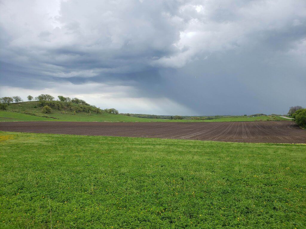
It’s a spring morning and the thickening clouds are dark and turbulent as they hover above the Yahara Watershed. Like shape-shifting billows of grey smoke, the formless masses of floating water vapor gather overhead. Lightning flashes and thunder cracks. Suddenly, a torrent of water unleashes from the blackened skies above. Cascading showers of raindrops pelt the rooftops, streets, and farm fields below. The all-consuming hiss, like radio static, is interrupted only by periodic thunderclaps. Salvos of speeding droplets explode into tiny bursts of watery shrapnel on impact. Soon, plants and tree canopies grow heavy with moisture. Bare soil liquefies to mud, and pooling water starts to creep downhill, following paths of least resistance.
The scene is a harbinger for what is to come. Creeks and streams will be among the first to react, swelling against their banks as this new payload is delivered and pushes along hydrologic freeways. Next, downstream lakes will begin to gradually rise within their basins, accepting the new surge of inflowing water at a higher rate than their fixed outlets can expel.
Following the landscape
The skyward influx of new water is both absorbed and repelled as it falls across a 384-square-mile watershed. Six cities, 11 villages, and 19 towns occupy the landscape that is simultaneously forgiving and unforgiving. With speeds and pathways guided by topography and land cover, the water from above travels where the watershed tells it to go. Tree canopies form the first line of defense, with their high tangles of leaves and branches intercepting the deluge like sticky umbrellas. Understory plants stand at the ready to serve as the next line of defense, like carpets of protection against the continuing onslaught. With thirsty roots channeling water into spongy soils, the earth naturally filters and cleanses the water as it percolates down into the deeper, geologic sandstone layers that lie deep below.
Seeping into and through the porous and gravely rock, rainwater that escaped thirsty roots begins its much slower journey downward and laterally beneath the earth. Lying buried hundreds of feet deep is a vast deposit of permeable, water-holding sandstone, providing 10 billion gallons of drinking water every year to Madison alone. Directed by the tilt of bedrock, the rainwater bleeds through a labyrinth of tiny sandstone voids and glacial rubble, eventually joining the “older” water of storms that have since come and gone. As groundwater levels rise in response, gravitational forces continue to nudge this slow, subterranean migration toward the nearest intercepting stream channel or lake basin. It is here where the water may once again reemerge as cool, bubbling springs that steadily feed and replenish nature’s vascularity.
Part 2: Engineered pathways
Over farmland, the rain finds fields sprouting with young crops or covered with pasture grass. Thirsty plants hold and drink what they can handle as soils absorb or shed what remains. Any exposed ground quickly saturates and then liquefies. As water percolates downward, it either feeds shallow groundwater aquifers or encounters the buried, horizontal drain tiles that direct it through pipes to a nearby stream or ditch.
Urban pathways
Over our cities and neighborhoods, the storm’s volley collides into armored rooftops, gathering in gutters and gushing out downspouts. It pours into roadside ditches and storm sewers, and is flushed through networks of culverts or underground pipes. Hardened, linear paths efficiently channel flows along predetermined paths. Water is shed off driveways, streets, and parking lots. At the same time, it encounters the patchwork of absorbent lawns, gardens, and parks that are the entry portals down into the otherwise shielded earth. The urban landscape drains quickly, much like a bathtub, or else risks flooding when structured pathways and points of discharge become overwhelmed or compromised.
It is with that same efficiency that rainwater scrubs accumulated debris and residue from our city streets, threatening to clog sewers and foul the surface waters to which it is being carried. Unlike the 55°F springs that seep from the ground, the water is warmer and unfiltered. And like a conveyor belt, it carries whatever it can gather along its route, limited only by the energy derived from its volume and velocity.
Part 3: Giant water basins
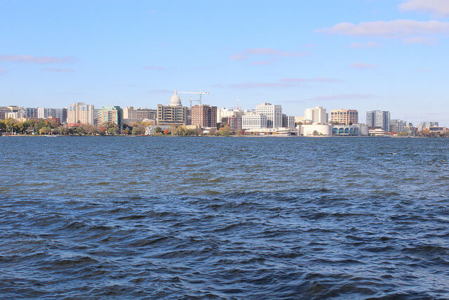
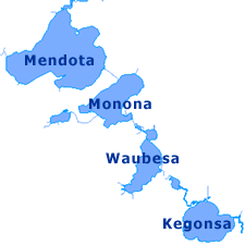
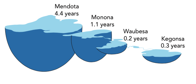
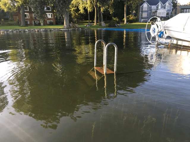
The Yahara River is the watershed’s main surface drainage artery, flowing from north to south, through the chain of lakes. It is a 43-mile ribbon of water (measured from its start in Columbia County to the outlet of Lake Kegonsa). The river collects and delivers the storm’s aftermath to massive, geologic depressions. Lakes Mendota, Monona, Wingra, Waubesa, and Kegonsa together hold 810 million tons of water. With a combined volume of more than 325 billion gallons, the lakes function as the temporary holding tanks of all that the watershed is capable of delivering. While continuously accepting water and releasing it through fixed outlets, the sheer size of the lakes means the average water molecule will require six years to make its way through the chain.
As the heavy storm clouds sweep across the Yahara Watershed, they also dump their contents directly onto the 29 square miles of lake surface. The water is cleaner, nutrient poor, and slightly more acidic without having come into contact with the surrounding land. It is also the first to touch the lakes, followed by storm runoff, and, in time, slow-moving groundwater. Stormwater flows into Lake Monona and Lake Wingra peak a day or two sooner compared to the other lakes. Their immediate drainage areas are largely covered by pavement that rockets rainwater through storm sewers.
Part 4: Pumping and treating
Nearly a half-million people call the watershed home. These individuals occupy approximately 275,000 houses, and the employed are generally going to separate buildings in the watershed. Life continues as the storm rumbles and weeps outside our protective cocoons. Faucets turn on, water bottles are filled, and toilets flush as we go about our day.
The potable water that flows from our taps is pumped from wells. Like giant straws, they extract from the reservoir of groundwater deep below the Earth’s surface. Once considered untouched and unspoiled, we know that is not the case. All water, regardless of location, is impacted by our activities. In our cities, utilities regularly test and treat the deep aquifer water for the regulated contaminants we know about and monitor. The same cannot be said for the shallower, private well water that serves our rural areas.
We pump 10 billion gallons of water every year from the aquifer beneath Madison to meet one city’s water demands. That equates to more than eight tons of water every minute at every operating well across the city. Madison alone has roughly 860 miles of water main under its streets to supply our homes and businesses.
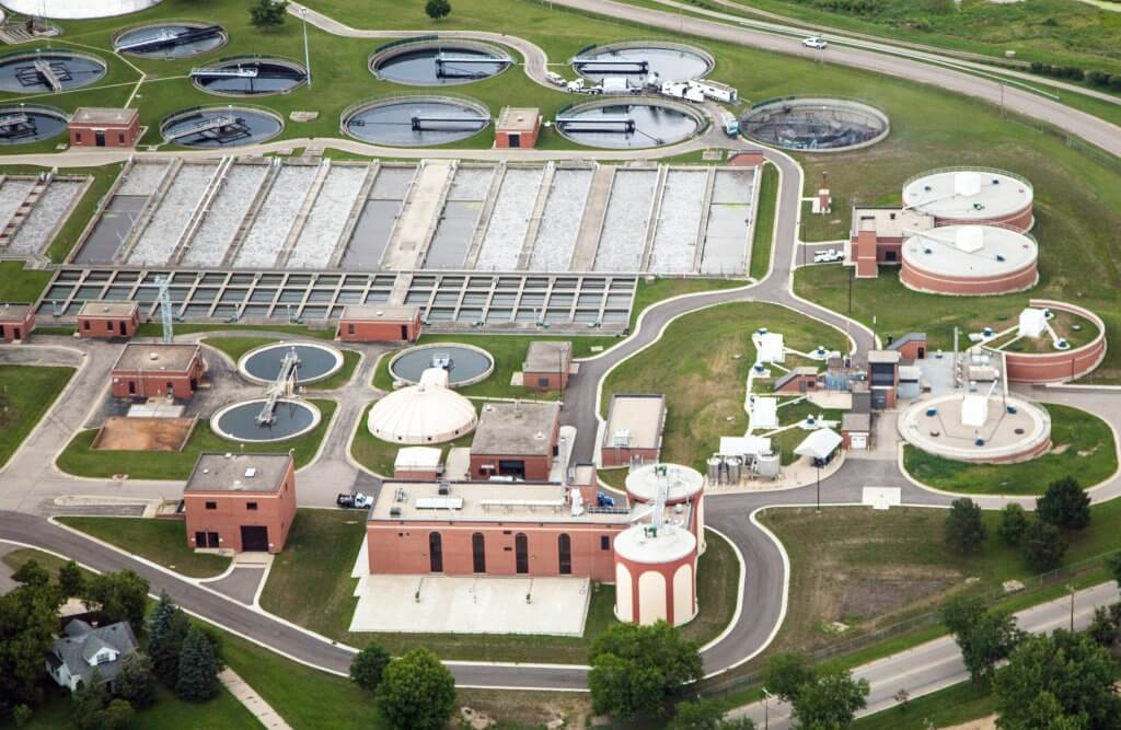
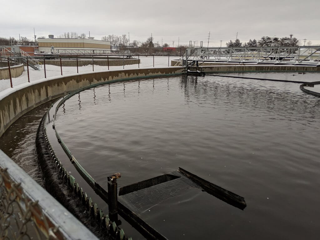
It is estimated that about 29% of the water that falls on the watershed each year is responsible for replenishing that aquifer. As it is used, water from our showers, sinks, and toilets is sent down drains into sanitary sewers. Piped and pumped to the Nine Springs Wastewater Treatment Plant near Lake Waubesa, the water goes through a multi-step separation and cleaning process. The water is then released into Badfish Creek and makes its way out of this watershed. It is a continual cycle of extraction, treatment, and out-of-basin discharge to the tune of 42 million gallons per day.
Part 5: Changing fate
Meteorologists will later report that the storm was measured as a 2.5-inch rainfall—an amount of water collected in a rain gauge over a 24-hour period. A storm of this intensity used to occur once per year on average in southern Wisconsin, but is seen more frequently with an increasingly wetter climate. Meteorologists will also note that average annual precipitation for our area has increased 24% since 1970. The trend portends more runoff and flooding down the road. For the storm that just passed, it will take more than two weeks for this latest pulse of water to traverse the watershed and its chain of lakes.
Before groundwater pumping began, area lakes and streams received an estimated 421 million gallons of spring water a day. That has dropped to about 373 million gallons a day, with many springs drying up and disappearing entirely. Lake Wingra alone has lost about half its previously documented springs.
Important choices
As the Yahara Watershed continues to develop, our community will have important choices to make. Will we allow even less water to infiltrate the ground to replenish our aquifers? Will we throw more unfiltered runoff at our lakes and streams? Or perhaps, will we waste even more water down our drains and toilets? The lifeblood and fate of our community are at stake, and it will be our collective actions that determine the future we choose.