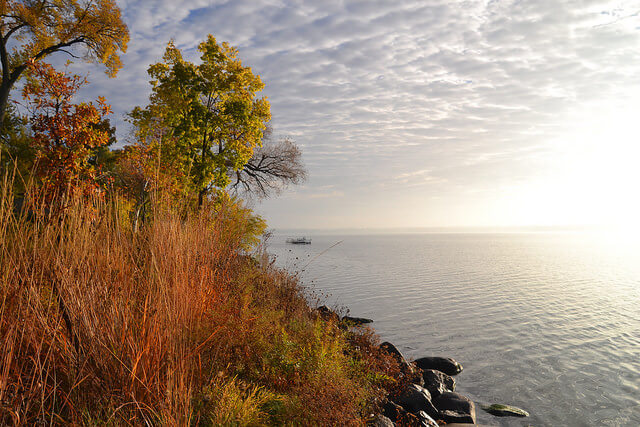
Lake Monona
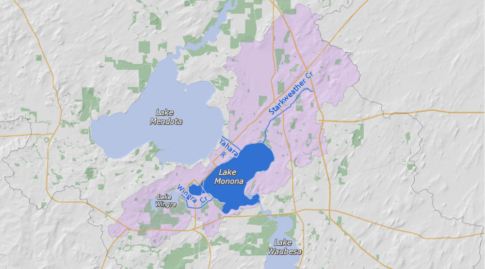
Lake Monona is the second lake in the Yahara chain of lakes. The land surrounding the lake is mostly urban and is fed by the Yahara River, Wingra Creek, and Starkweather Creek.
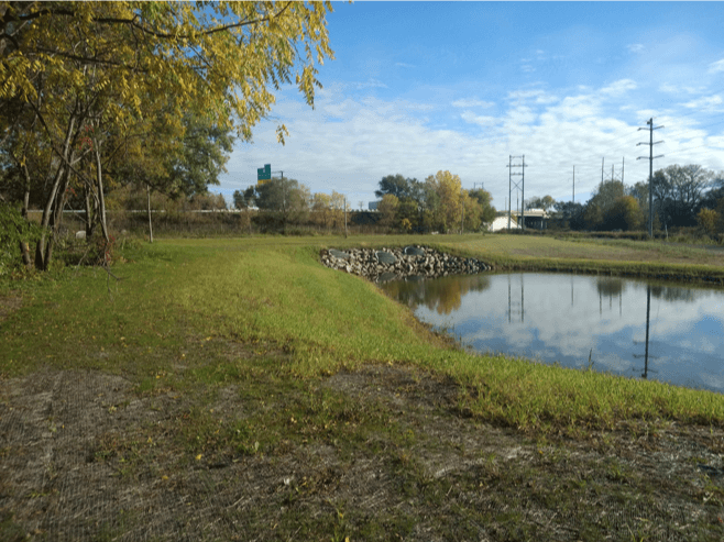
Over the years, Lake Monona has faced water quality issues from urban runoff and from industrial sites. Besides the Yahara River, the largest source of phosphorus coming into Lake Monona is from Starkweather Creek. Most of the land surrounding and directly draining to the lake is urban. The Yahara CLEAN plan for the Lake Monona Watershed calls for action to improve leaf management and reduce erosion from construction sites.
Lake Monona by the numbers
The land between Lake Mendota and Lake Monona forms Madison’s iconic isthmus. Madison is one of only two major U.S. cities to be located on an isthmus. (The other city is Seattle, Washington.) Lakes Monona and Mendota are the only lakes in the Yahara chain classified as “deep” by the Wisconsin Department of Natural Resources criteria.
- Watershed area: 61,643 acres
- Surface area: 3,274 acres
- Shoreline: 13 miles
- Maximum depth: 64 feet
- Mean depth: 27 feet
- Flushing rate: 9.5 months
How was the water (2019)?
2019 average (July – August) water clarity and phosphorus concentrations both ranked “fair,” according to Wisconsin DNR criteria for deep lakes.
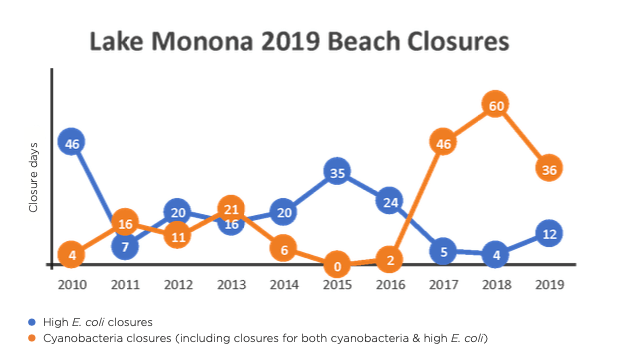
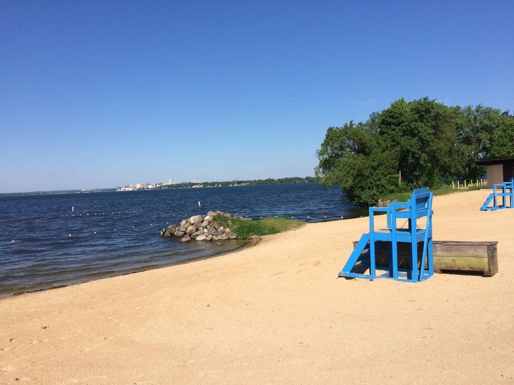
Lake Monona beaches were closed 48 times during the summer of 2019, primarily due to cyanobacteria blooms or both cyanobacteria and high E. coli (75%). A total of seven Lake Monona beaches are monitored.
2019 Community projects & initiatives
- City of Madison improved stormwater management at Nautilus and Jacobson Fury Ponds, and made streambank repairs along Daley Drive and Tree Lane. The City also restored natural areas by planting pollinator prairies along Inner Drive and established native plants around Dondee Pond. The City collected approximately 1,600 additional tons of leaves compared to the five-year average, and continued its Expanded Erosion-control Enforcement Program.
- City of Monona dredged North Winnequah Park Lagoon, stabilized the lagoon’s shoreline, installed new fish-habitat features, and expanded an adopt-a- storm drain program. In total, the City has had 110 drains adopted by volunteers to keep them free of leaves and dirt.
- Friends of Starkweather Creek began working with the Capital Area Regional Planning Commission on a Starkweather Creek Watershed chloride study, collaborated with partners to maintain the rain garden at Washington Manor Park, and removed invasive vegetation from along the creek corridor.
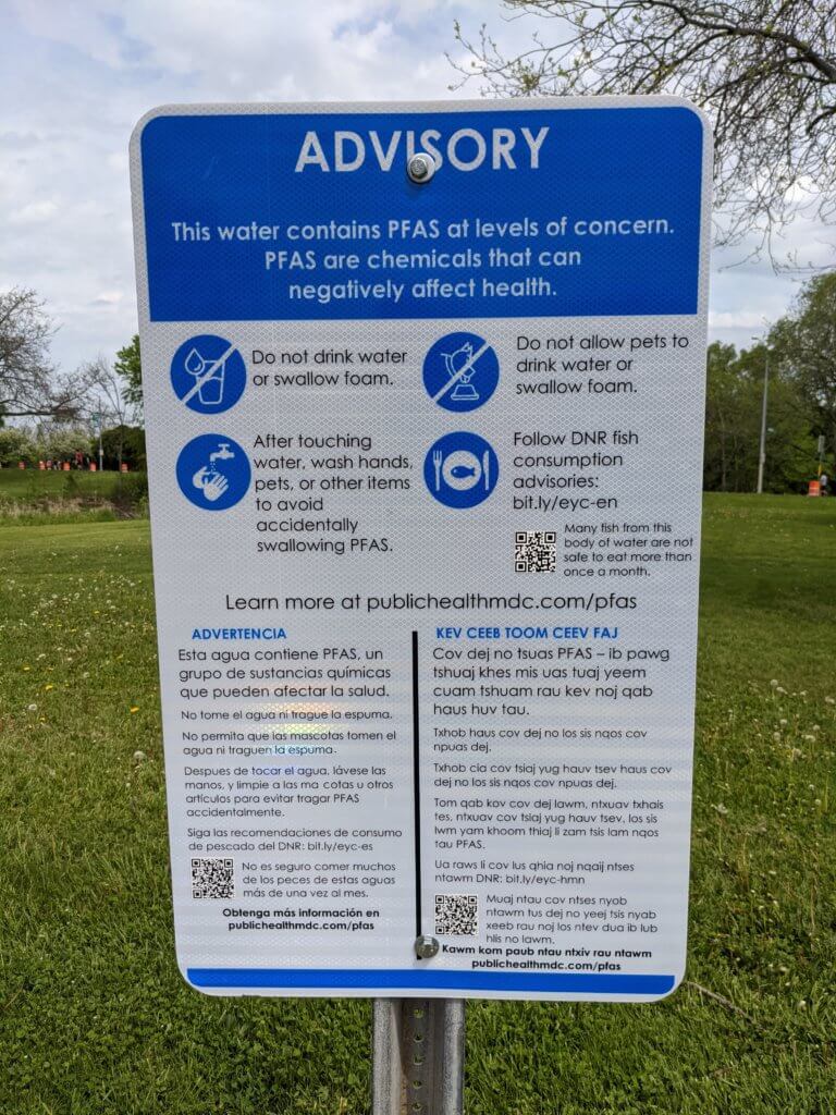
Per- and poly-fluoroalkyl substances (PFAS) were found in high concentrations at Truax Field and in nearby Starkweather Creek in 2019. The Wisconsin DNR issued a fishing advisory on Lake Monona to limit consumption of and exposure to the contaminant.
For an update on the latest phosphorus reduction projects within the watershed, see the State of the Lakes Annual Report.
Organizations supporting Lake Monona
The following groups work on water quality issues in the Lake Monona watershed.
City of Madison
City of Monona
Dane County
Friends of Monona Bay
Friends of Starkweather Creek
Madison Water Utility
Public Health Madison & Dane County
Yahara Watershed Improvement Network
Friends of the Yahara River Parkway
Read about the other lakes of the Yahara Watershed
Here’s how Lake Monona faired in previous years:
Lake Monona 2018
How was the water?
In 2018, total phosphorus levels and water clarity were “good” in the middle of the lake, according to DNR criteria. However, the six citizen monitor reports of cyanobacteria blooms were above the 4-year summer median of 7.5. Beaches were closed a record number of days, primarily due to cyanobacteria blooms.
Water clarity (2018 data)
- 6.6 feet or “good” according to Department of Natural Resources criteria for deep lakes
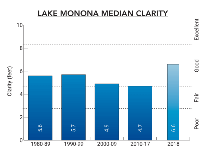
Data WDNR (1975-1994), NTL-LTER (1995-2018)
Phosphorus levels (2018 data)
- 0.030 mg/L or “good” according to Department of Natural Resources criteria for deep lakes

Data WDNR (1975-1994), NTL-LTER (1995-2018)
Beaches (2018 data)
- Closed 22% of the time and open 78% of the time
- 44 closure days due to cyanobacteria (blue-green algae)
- 4 closure days due to E. coli bacteria
- 16 additional closure days due to both E. coli and cyanobacteria (blue-green algae)
- 91 beach closure days due to flooding
In contrast to conditions in the middle of the lake, a large number of cyanobacteria blooms closed beaches located on the nearshore of the lake. According to data collected by Public Health Madison & Dane County, Lake Monona’s beaches were closed a record number of 64 days from Memorial Day to August 20th. The long-term median is 33 days for the whole summer. Beaches were closed primarily due to cyanobacteria or a combination of high E. coli and cyanobacteria. After August 20th, all the beaches were closed for the remainder of the season (August 21 – Labor Day) due to flood conditions.
What’s new on Lake Monona?
Lake Monona summer water quality conditions are now linked to the recent invasion of zebra mussels. The full effect of zebra mussels in the Yahara lakes is still uncertain. Results from other infested lakes suggest increases in water clarity in the middle of the lakes will occur. However, shoreline management problems could get worse from increased aquatic plant growth, and possible increases in filamentous algae and scums of cyanobacteria.
Summer water quality in 2018 was also impacted by the unusual amount of flow into and out of the lake. Increased flows were the result of above normal precipitation in the region.
2018 Lake Monona projects
- Dane County granted funds to City of Madison for an Ultra Low-Dose Alum Pilot. The pilot project is a collaboration with the University of Wisconsin-Madison to assess the effectiveness of adding a trace amount of aluminum sulfate. Alum is added to detention basins to prevent phosphorus from leaching from captured sediment. It is a chemical that binds to phosphorus, making it unavailable for algae growth.
- City of Madison
- Completed work on the Jacobson Furey Pond near Starkweather Creek and Dondee Pond near Highway 51 and Cottage Grove Road
- Repaired river banks at Heritage Prairie Greenway
- Constructed nine terrace rain gardens and expanded public messaging about leaf-free streets
- City of Monona
- Removed phosphorus-laden sediment from Winnequah Park Lagoon
- Added 29 storm drains to their “Adopt a Storm Drain and Leaf Management Program”
- Cleaned one-third of the city’s inlet catch basins Friends of Starkweather Creek held monthly outings to spark interest in the creek. The city also restored areas near the Dixon Greenway, Washington Manor Park, and Eken Park with native plantings.
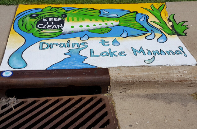
Photo courtesy of City of Monona
Lake Monona 2017
Water clarity (2017)
- 5.1 feet or "good" according to Department of Natural Resources criteria for deep lakes
Phosphorus levels (2017)
- 0.037 mg/L or "fair" according to Department of Natural Resources criteria for deep lakes
Beaches (2017)
- Open 93% of the time and closed 7% of the time
- 5 closure days due to E. coli bacteria; 27 closure days due to cyanobacteria (blue-green algae)
- 19 additional closure days at Olbrich Park due to both E. coli and cyanobacteria (blue-green algae)
Lake Monona 2017 news
Lake Monona's beaches were closed 51 days out of the total 693 possible beach days (99 days multiplied by 7 beaches), mostly due to cyanobacteria or a combination of high E. coli and cyanobacteria. Olbrich Beach lost the most beach days. These closures were higher than the long-term median for the lake.
Lake Monona 2016
Water clarity (2016)
- 6.2 feet or "good" according to Department of Natural Resources criteria for deep lakes
Phosphorus levels (2016)
- 0.022 mg/L or "good/excellent" according to Department of Natural Resources criteria for deep lakes
Beaches (2016)
- 24 closure days due to E. coli bacteria
- 2 closure days due to cyanobacteria (blue-green algae)
- 0 closure days due to the combination of E. coli and cyanobacteria (blue-green algae)
Lake Monona 2015
Water clarity (2015)
- 4.6 feet or "fair" according to Department of Natural Resources criteria for deep lakes
Phosphorus levels (2015)
- 0.026 mg/L or "good" according to Department of Natural Resources criteria for deep lakes
Beaches (2015)
- 35 closure days due to E. coli bacteria
- 0 closure days due to cyanobacteria (blue-green algae)
- 0 closure days due to the combination of E. coli and cyanobacteria (blue-green algae)
Lake Monona 2014
Water clarity (2014)
- 4.1 feet or "fair" according to Department of Natural Resources criteria for deep lakes
Phosphorus levels (2014)
- 0.030 mg/L or "good" according to Department of Natural Resources criteria for deep lakes
Beaches (2014)
- 20 closure days due to E. coli bacteria
- 6 closure days due to cyanobacteria (blue-green algae
Lake Monona 2013
Water clarity (2013)
- 3.6 feet or "fair" according to Department of Natural Resources criteria for deep lakes
Phosphorus levels (2013)
- 0.026 mg/L or "good" according to Department of Natural Resources criteria for deep lakes
Lake Monona 2012
Water clarity (2012)
- 4.9 feet or "fair/good" according to Department of Natural Resources criteria for deep lakes
Phosphorus levels (2012)
- 0.027 mg/L or "good" according to Department of Natural Resources criteria for deep lakes