
BY SUSAN SWANSON, DIRECTOR, STATE GEOLOGIST
WISCONSIN GEOLOGICAL AND NATURAL HISTORY SURVEY & UW-MADISON DIVISION OF EXTENSION
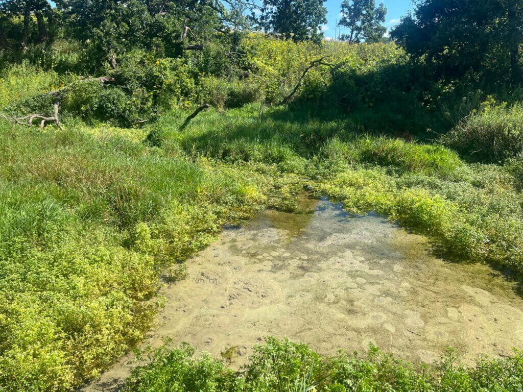
The Greater Madison Area is well known for its lakes, but the region is also rich with springs, where shallow groundwater naturally flows to the surface. The Yahara lakes and the broad wetlands that surround them, such as Cherokee Marsh or the Waubesa Wetlands, are also partly fed by groundwater. But in a spring, the groundwater emerges in a concentrated, visible form, often lifting and suspending sand from the bottom of a pool, flowing from a fracture in a rock outcrop, or even creating a stream depending on the volume of water.
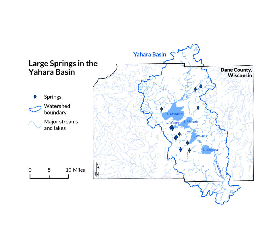
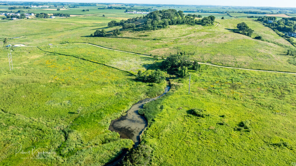
Some of the largest springs in the Yahara Watershed roughly encircle the central portion of the Yahara chain of lakes, prompting the question of why this pattern and prevalence of springs exists). The geological setting and properties of the regional aquifers provide possible clues and explanations.
A landscape shaped by rock and ice
Much of south-central Wisconsin sits atop sedimentary rock layers, such as sandstone, limestone, and shale. But in some places, like beneath the Yahara lakes corridor, the surface of the bedrock is deeply carved by preglacial river valleys. After glaciers advanced over this landscape and later retreated, abundant meltwaters deposited sand and gravel in the valleys, hiding them from view beneath our modern land surface.
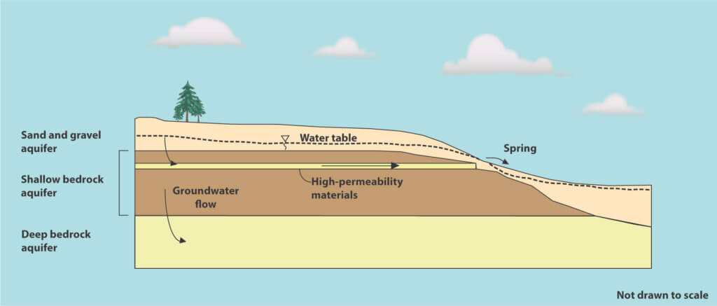
A thick sandstone formation known as the Mount Simon aquifer forms the deepest sedimentary rock layer in southern Wisconsin. The highly productive aquifer supplies drinking water to residents of Madison and many surrounding communities. The amount of time it takes for precipitation to infiltrate and then circulate through the deep Mount Simon aquifer is very long, often measured in hundreds to thousands of years.
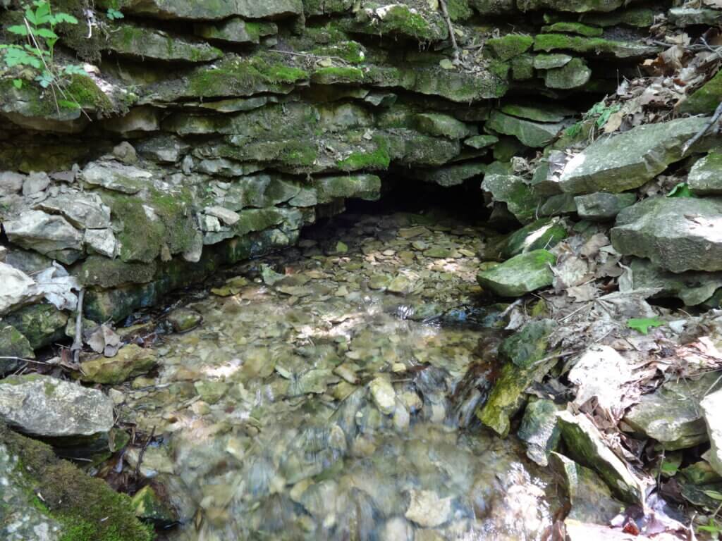
The springs in the Yahara lakes region, on the other hand, are fed by precipitation and groundwater that flow downward through the overlying sand and gravel aquifer and within shallower sandstone and limestone layers. Where groundwater encounters fractures and highly permeable zones in this shallower bedrock aquifer, it can discharge as a spring where the rock is exposed on the land surface or near a shallowly buried margin of a bedrock valley. The time it takes for precipitation to infiltrate and then flow through the shallower bedrock aquifer to the springs is shorter, ranging from decades to centuries.
Why springs matter
Beyond their natural beauty, springs play a critical role in our local ecosystems and offer a window into groundwater quality. Near the Madison area, springs provide a consistent source of water that sustains water levels for wildlife and sensitive wetland habitats during extended dry periods. Additionally, because the water temperature is nearly constant (around 50°F/10°C in southern Wisconsin), the area around a spring is often green and lush, even in winter.
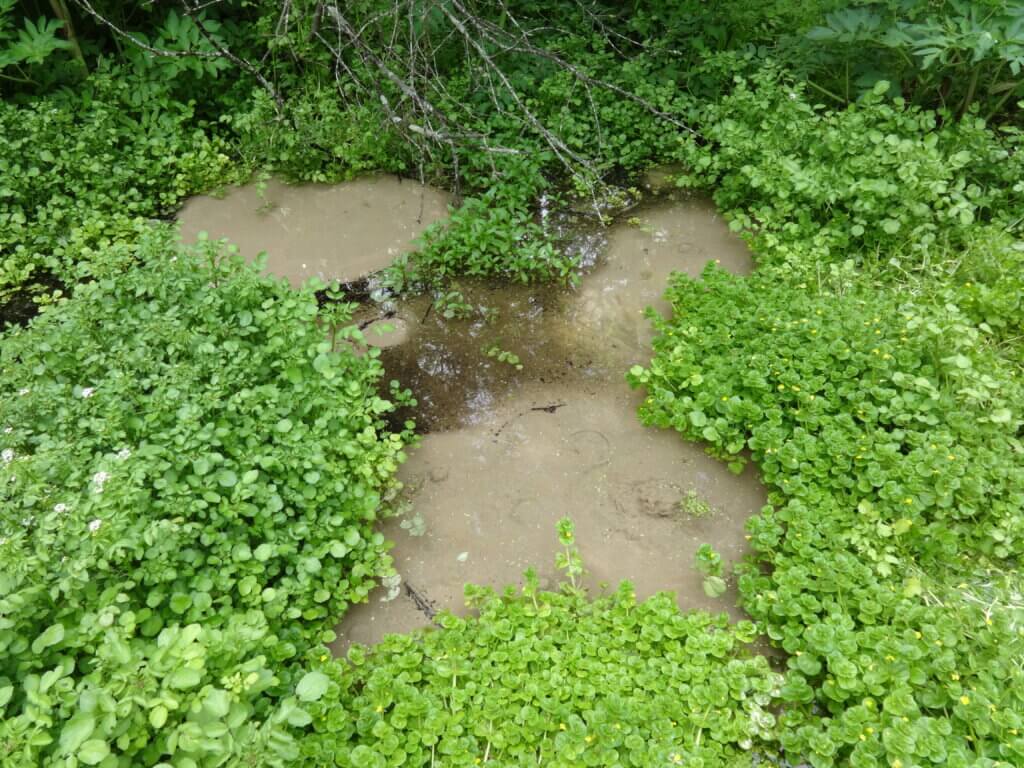
Spring flow and water quality can also serve as indicators of the health of the near-surface aquifer, making springs critical environmental monitoring points. Although aquifers naturally filter spring water, the water is not always pure or safe to drink. Because the water emerging from springs flows through the sand and gravel aquifer and the shallow bedrock aquifers most affected by human activity, spring water is vulnerable to surface contaminants like nitrates (from agricultural runoff and septic systems) and chlorides (from road salt use).
Geology and land use
The concentration of springs in the Yahara Watershed and the quality of the water that emerges ultimately depends on the region’s unique geology and land use practices within the watershed. Springs exist across Wisconsin and in a variety of settings that reflect the state’s diverse geology.
Sacred waters of Teejop
Written by Samantha Skenandore, Federal Indian and Tribal Law experienced attorney with Skenandore Wilson LLP, and an enrolled member of the Ho-Chunk Nation.
For the Ho-Chunk people, the Yahara River Watershed, known as Teejop (translating to “Four Lakes”), has been an important cultural settlement hub continuously occupied by them for centuries. According to Ho-Chunk teachings, Mauna, the Creator, is responsible for creating the four deep lakes of the region.
Many of the ancient effigy mounds in the Yahara lakes region are located near springs, highlighting the spiritual significance of these water sources. Springs are sacred sites that serve as a spiritual link to the underworld. These natural groundwater outlets are traditionally revered as places of offerings, healing, connection, and ceremony.
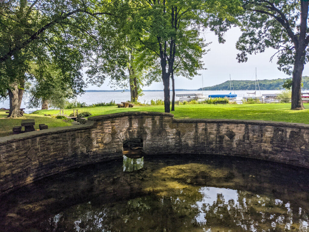
The Ho-Chunk name for the springs is Makamai, meaning “medicine springs.” Spring water is considered a “medicine,” carrying special healing powers. The Ho-Chunk people have long offered tobacco and food where land meets these sacred waters as a way to offer prayer and receive blessings.
Today, the Yahara River Watershed and these springs remain sacred to Ho-Chunk residents, serving as a link between their ancestors and the land.
Learn more
To learn more about the springs in the Yahara Watershed and across Wisconsin, visit the Wisconsin Geological and Natural History Survey’s overview of springs in Wisconsin: home.wgnhs.wisc.edu
This article first appeared in the 2026 Teejop Regional Guide (formerly known as the Greater Madison Lake Guide). Read more from the publication.