Yahara chain of lakes: Water level orders and challenges
By John Reimer, Assistant Director of Dane County Land & Water Resources Department
Article first published in the 2023 Greater Madison Lake Guide, a Clean Lakes Alliance publication
Cascading flow
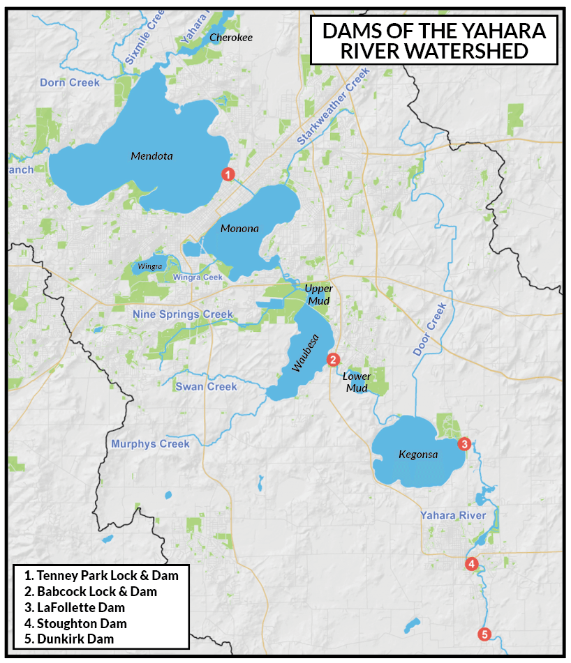
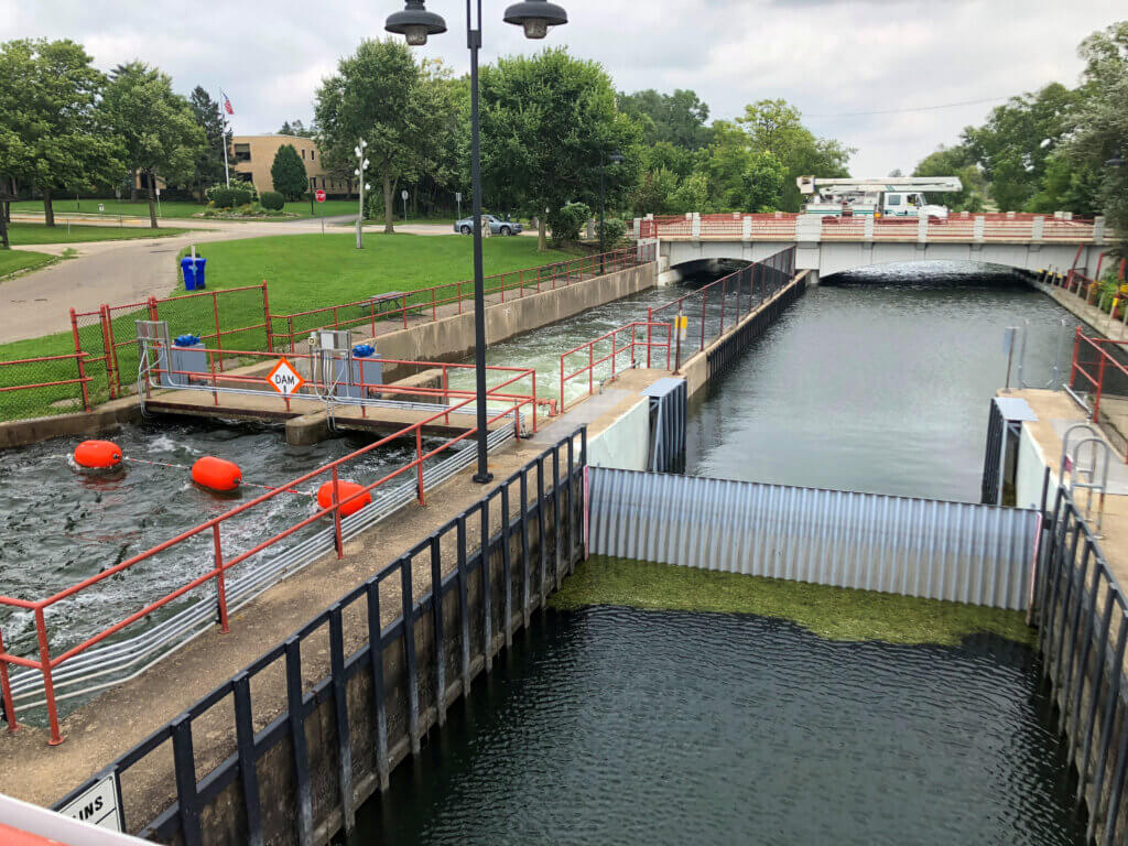
The Yahara River chain of lakes is made up of several “lakes,” including Cherokee, Mendota, Monona, Upper Mud, Waubesa, Lower Mud, and Kegonsa (see map). The Yahara River inflow enters from the north and discharges into Lake Mendota through a narrow channel at the Highway 113 bridge.
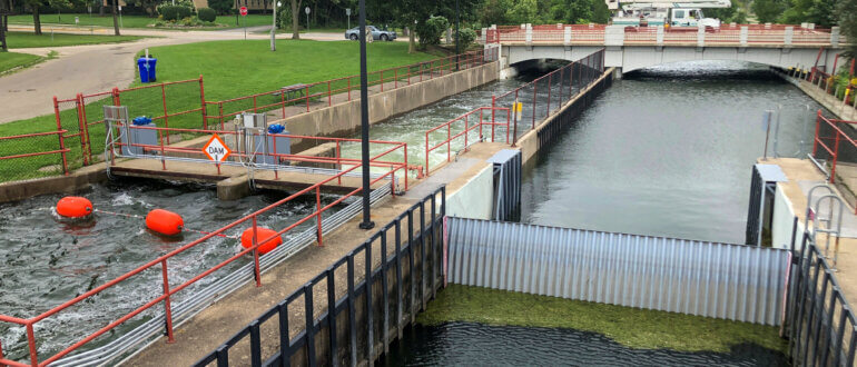
When storm events occur, large amounts of runoff enter Lake Mendota from the Yahara River. For example, in the summer of 2008, a large rain event produced peak flow of over 1,600 cubic feet per second (cfs), or about 12,000 gallons per second, entering Lake Mendota from the Yahara River. At Lake Mendota, the water level is controlled by Tenney Dam. The dam raised the original water level by 4.5 feet after its construction in 1847. Water released from Lake Mendota enters Lake Monona, travels through the uncontrolled river channel to Upper Mud Lake. Eventually, water reaches Lake Waubesa where the water level is controlled by Babcock Dam. Past the dam, water flows along the Lower Mud Lake river corridor and enters Lake Kegonsa. Finally the water level at Lake Kegonsa is controlled by the LaFollette Dam.
Water level orders
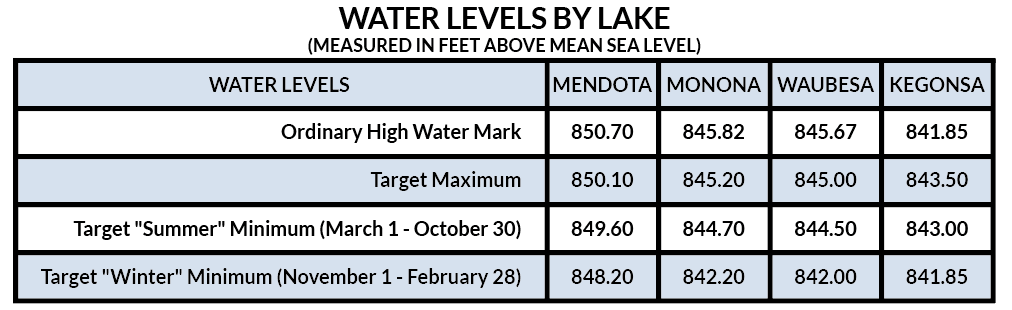
Water level orders were set by the Wisconsin Department of Natural Resources (DNR) in 1979, establishing a summer maximum and minimum for lakes Mendota, Monona, Waubesa, and Kegonsa. The summer orders establish a six-inch range on all lakes and seek to balance competing interests, such as navigation, flood control, fisheries, and recreation. The orders do not specify how to achieve water levels through the operation of the three dams. Thus in 2010 and updated in 2019, the Dane County Lake Level Management Guide for the Yahara chain of lakes was developed in consultation with experts, approved by the Lakes & Watershed Commission, and peer reviewed. The management guide is intended to provide guidance for lake managers such as in times of high lake levels.

Flow barriers
High lake levels caused by inefficient water delivery are often perceived by the public as failure to open the dams. However, high lakes levels are more often caused by flow limitations in the rivers and other factors. For example, in 2018, Babcock and LaFollette dams were wide open the entire year. However, flooding still occurred later that year. Several flow limitations in the Yahara River exist, such as narrow bridges, sediment deposits, and debris (tree trunks and boulders) which block flow. Also, the river slope between the lakes is nearly flat. The gentle slope moves water slowly through the river and out of the system. Under normal conditions, the change in water level between lakes Monona and Waubesa is 0.4 feet over 2 miles (0.004% slope). Aquatic plants restrict flow by creating friction to the moving water.
Management solutions
During the 2018 flood, Dane County cut aquatic plants between lakes Waubesa and Kegonsa. The County obtained special permission from the Wisconsin DNR to conduct additional harvesting in the Yahara River south of Lake Kegonsa, nearly doubling flow from approximately 400 to 900 cfs and helped minimize flooding. Other factors that contribute to flooding include increased runoff volumes due to urbanization, enhanced drainage of agricultural lands, wetland loss, and increases in the amount and intensity of rainfall. In order to combat these water volume challenges for the Yahara lakes, several actions are underway. Some examples of current actions being performed by Dane County to mitigate flooding are:
- Purchase of lands for prairie/wetland restorations
- Ordinance updates to improve storm water controls for construction of impervious surfaces
- Cost-share funds to municipalities for improving storm water runoff
- Cost-share programs to implement agriculture practices that improve water infiltration
- Increased aquatic plant cutting in the Yahara River
- Sediment removal in the Yahara River to improve flow